Archaeology
Ammaia
Ammaia, a Roman city in Lusitania located in São Salvador da Aramenha, Marvão, featuring a forum, baths, and monumental gate, classified as a National Monument.
- Location
- São Salvador da Aramenha (Marvão), Portalegre
- Built
- Séc. I a.C. – séc. V d.C.
- Style
- Arquitetura romana
Ammaia was a Roman city in the province of Lusitania, situated on a gentle slope near the River Sever, in the current parish of São Salvador da Aramenha, municipality of Marvão. It rose under the shelter of the Serra de São Mamede, in a border territory connecting the interior of Alentejo to the great provincial capital of Emerita Augusta (Mérida). Today, its ruins constitute one of the most important Roman sites in northern Alentejo, classified as a National Monument since 1949.
From foundation to urban status
Archaeological research in recent decades indicates that intensive settlement of the site already existed around the reign of Augustus, at the end of the 1st century BCE. The settlement obtained the status of civitas in 44–45 CE, likely under Claudius, later achieving the rank of municipium — a promotion usually attributed to the Flavian period. Ammaia thus became the head of a vast rural territory, linked to the road network that structured southern Roman Hispania. Its prosperity lasted into Late Antiquity, with traces of occupation extending into the 5th century.
The forum, the baths, and the South Gate
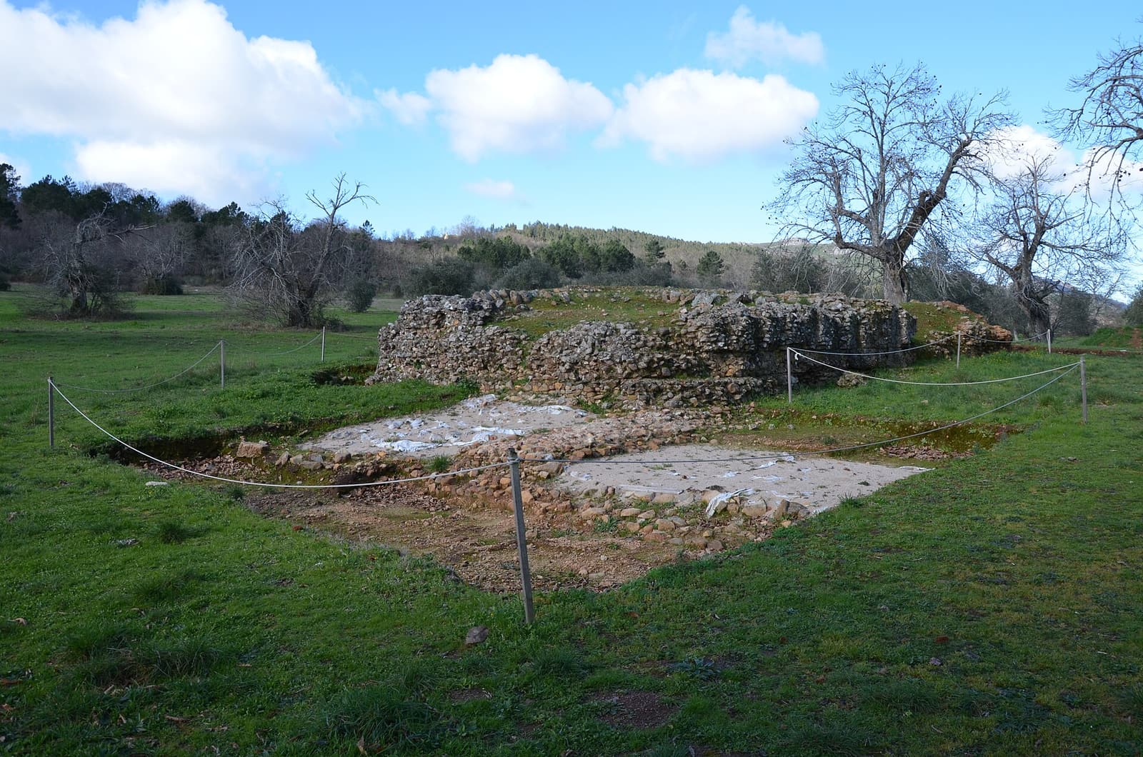
The civic heart of the city was the forum, a vast monumental square overlooking the southern area, where the podium of a temple (approximately 18 by 9 meters) and the remains of the basilica and curia are preserved. Nearby stood a bath complex, of which a small marble-lined tank — interpreted as a possible frigidarium — and a pool (natatio) survive.
The most emblematic image of Ammaia, however, is its South Gate, the main entrance to the city, flanked by two circular towers about six meters in diameter connected by an arch. This was where the road leading to Mérida passed, symbolically marking the threshold between the countryside and the city. The urban layout followed the Roman grid, with the cardo maximus structuring the blocks within a wall enclosing about twenty hectares.
Only a small fraction of the city has been excavated: geophysical surveys reveal that an entire city remains buried beneath the fields, still unexplored.
Rediscovery, research, and visit
Although the memory of Ammaia was never entirely lost, it was from the 1990s onwards that the site saw systematic research, first by the Fundação Cidade de Ammaia and, since 2007, under the scientific coordination of the University of Évora. Non-invasive survey methods — geophysics, aerial photography, and surface surveys — have made the site an international reference for the study of Roman cities without extensive excavation, even suggesting structures such as a possible amphitheater.
The site now forms part of an archaeological park with an on-site museum, housed at Quinta do Deão, where coins, ceramics, glass, and architectural elements recovered during excavations are displayed. The visit can be complemented by exploring the historic village of Marvão and its medieval castle, atop the mountain, and fits into the broader context of Roman Portugal and its archaeology. The connection to Mérida also recalls the role of Roman roads in territorial cohesion, a theme Ammaia shares with larger sites like Conímbriga.
Frequently asked questions
- Where is the Roman city of Ammaia located?
- Ammaia is situated in the parish of São Salvador da Aramenha, municipality of Marvão, district of Portalegre, near the Serra de São Mamede, in Alto Alentejo.
- Is Ammaia classified as a National Monument?
- Yes. The ruins of Ammaia have been classified as a National Monument since 1949 and are part of an archaeological park with an on-site museum.
- What can be visited in Ammaia?
- Excavated and visitable areas include the forum with the temple podium, a bath complex, and the South Gate flanked by two circular towers, as well as the museum at Quinta do Deão.