Monuments
Forte da Praia da Consolação (Peniche)
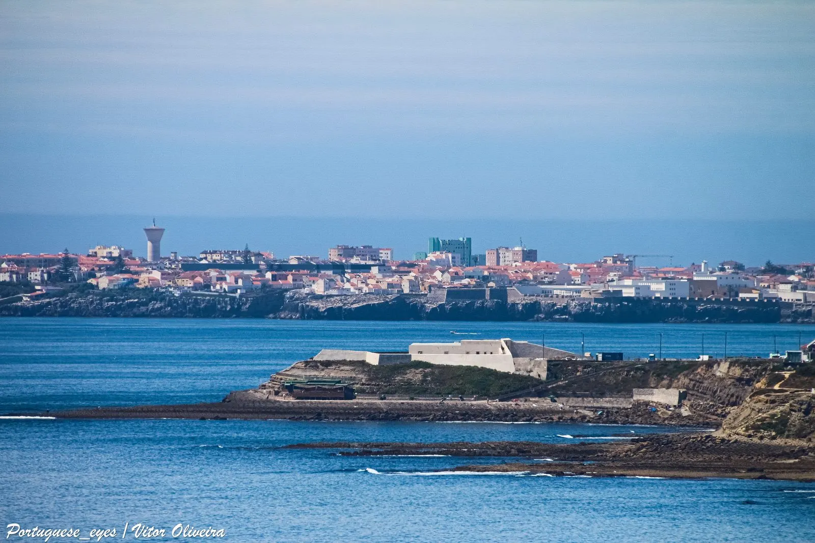
Peniche's Forte da Consolação is a bastioned fort of the Restoration, raised from 1641 to 1645 on a rock on the beach and a National Monument since 1978.
- Location
- Consolação, Atouguia da Baleia, Peniche, Leiria
- Built
- 1641–1645; ampliado em 1657 e 1675
At the southern end of Consolação beach, in the civil parish of Atouguia da Baleia, a small white fort rests on a rocky mass between the sand and the sea. This is the Forte da Praia da Consolação, also called Forte de Nossa Senhora da Consolação. It was built in the early years of the Restoration War to defend the bay of Peniche. Across the bay, about eight kilometres away, stands the Fortaleza de Peniche, with which it was meant to cross fire.
A piece of coastal defence after 1640
The national register of the Portuguese Cultural Heritage, I.P. indicates that the fort was built between 1641 and 1645, on the initiative of D. Jerónimo de Ataíde, Count of Atouguia. The bay of Peniche, opposite the village of Atouguia da Baleia, was highly exposed to corsair attacks. A second fortified point, on the southern side of the bay, allowed ships approaching to be struck by the crossfire of the two fortresses.
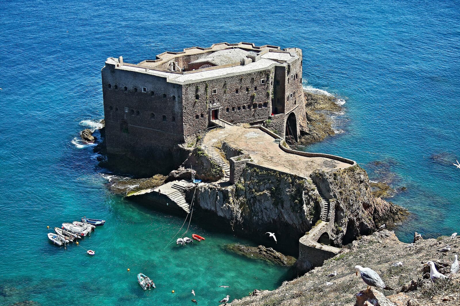
The same register places the work within the plan to defend the maritime frontier after the Restoration. The existing coastal fortresses were, for the most part, from the sixteenth century. The plan reinforced them with a network of small fortified points, chiefly forts and batteries, which gave the troops mobility. On this network, see Portugal’s coastal forts and the Forte de São João Baptista on the Berlenga, which completed Peniche’s defensive system.
A star-shaped plan on the rock
The main entrance faces the land and is separated from it by a moat, crossed by a bridge resting on two full round arches. The plan is star-shaped, with four triangular bastions: two larger ones facing east, on the landward side, and two smaller ones pointing towards the sea. Between the latter runs a curtain wall with five flagstone platforms, where the guns were mounted.
Around the parade ground stand the former barracks and the chapel, now no longer in use for worship. These buildings, parallel to one another, form a rectangular courtyard open to the sea. The gate of arms is a large full round arch with a rusticated moulding, flanked by two pilasters. Above it, on the axis of the gate, is a stone plaque with an inscription recording the foundation and construction of the fort, crowned by the national coat of arms.
Extensions and restorations
The fort was not left as it was designed. According to the national register, it was extended in 1657 and in 1675. The earthquake of 1755 destroyed part of the battery facing the sea, which had to be rebuilt. The five artillery platforms between the seaward bastions were completed in 1796. In 1800 a battery with fifteen gun-ports was built on the outside, to the east, forming an entrenched camp that would prevent an approach by land. In 1832, during the civil war between liberals and absolutists, the structure was restored once again.
From holiday colony to National Monument
The fort lost its military functions in the first half of the twentieth century. In 1947 it was occupied by a children’s holiday colony run by the Religious of the Sacred Heart of Mary, and the interior buildings were refurbished in 1954 for that use. In 1974 the headquarters of the Associação Recreativa Forte Clube da Consolação was established there.
The fort is a National Monument under Decree No. 95/78, published in the Diário da República, I Série, No. 210, of 12 September 1978. The procedure had been initiated in 1975 and approved in January 1976. The national register does not indicate a fixed special protection zone. The fort does not form part of any UNESCO inscription.
The cliff and the municipal project
The cliff on which the fort stands is fragile. According to the Lusa news agency, in a report from April 2017, a landslide in 2010 put the fort at risk and led the Municipal Council to request urgent intervention. The consolidation of the cliff took place between 2014 and 2015.
In 2017, the State handed the fort over to the Câmara Municipal de Peniche for 25 years. The national register and the same news report describe the project: a museum hub, or interpretation centre, dedicated to the military heritage of the region and to the geological heritage of the municipality, with a multipurpose space. When consulted on 5 November 2026, we did not find official information on the execution of this project or on the opening of the interior to the public.
Planning the visit
The fort is at the southern end of Consolação beach. The exterior, the moat, the bridge and the gate of arms can be seen from the sand and the neighbouring paths. When consulted on 5 November 2026, we did not find an official visiting schedule for the interior. Please check with the Câmara Municipal de Peniche before going.
On the same trip, you can visit the Fortaleza de Peniche, which houses the Museu Nacional Resistência e Liberdade. To compare with other works of the same period, see the bastioned fortresses. For the regional context, see Centro, and for the national network, castles of Portugal.
Photograph by Vitor Oliveira, dated 2 July 2021. Original on Wikimedia Commons, under CC BY-SA 2.0; resized and compressed for the web, without altering the composition.
Frequently asked questions
- Who commissioned the Forte da Consolação?
- According to the national register of the Portuguese Cultural Heritage, the fort was built between 1641 and 1645 on the initiative of D. Jerónimo de Ataíde, Count of Atouguia, as part of the coastal defence effort following the Restoration of 1640.
- What was it used for?
- It defended the bay of Peniche, which was exposed to corsairs, crossing fire with the fortress of the town of Peniche, on the other side of the bay, about eight kilometres away.
- What is its classification?
- It is a National Monument under Decree No. 95/78, published in the Diário da República, I Série, No. 210, of 12 September 1978.
- Can it be visited?
- The exterior, the bridge and the moat can be seen from the beach and the neighbouring paths. When consulted on 5 November 2026, we did not find an official visiting schedule for the interior, nor confirmation that the planned interpretation centre is already open.
Sources
- Património Cultural, I.P. — Forte da praia da Consolação (71113)
- Património Cultural, I.P. — Atlas do Património Classificado, Forte da praia da Consolação (NINV 3119)
- Diário da República — Decreto n.º 95/78, de 12 de setembro
- Diário de Notícias (Lusa) — Câmara de Peniche vai gerir Forte da Consolação por 25 anos (28-04-2017)
- Wikidata — Forte da Praia da Consolação (Q10283741)
Keep exploring
Heritage nearby
More places to discover from here. Approximate straight-line distances, within 50 km.