Places
Schist Villages of Tejo-Ocreza
Discover the four Schist Villages of Tejo-Ocreza: Água Formosa, Figueira, Martim Branco and Sarzedas, with history, heritage, streams and visitor info.
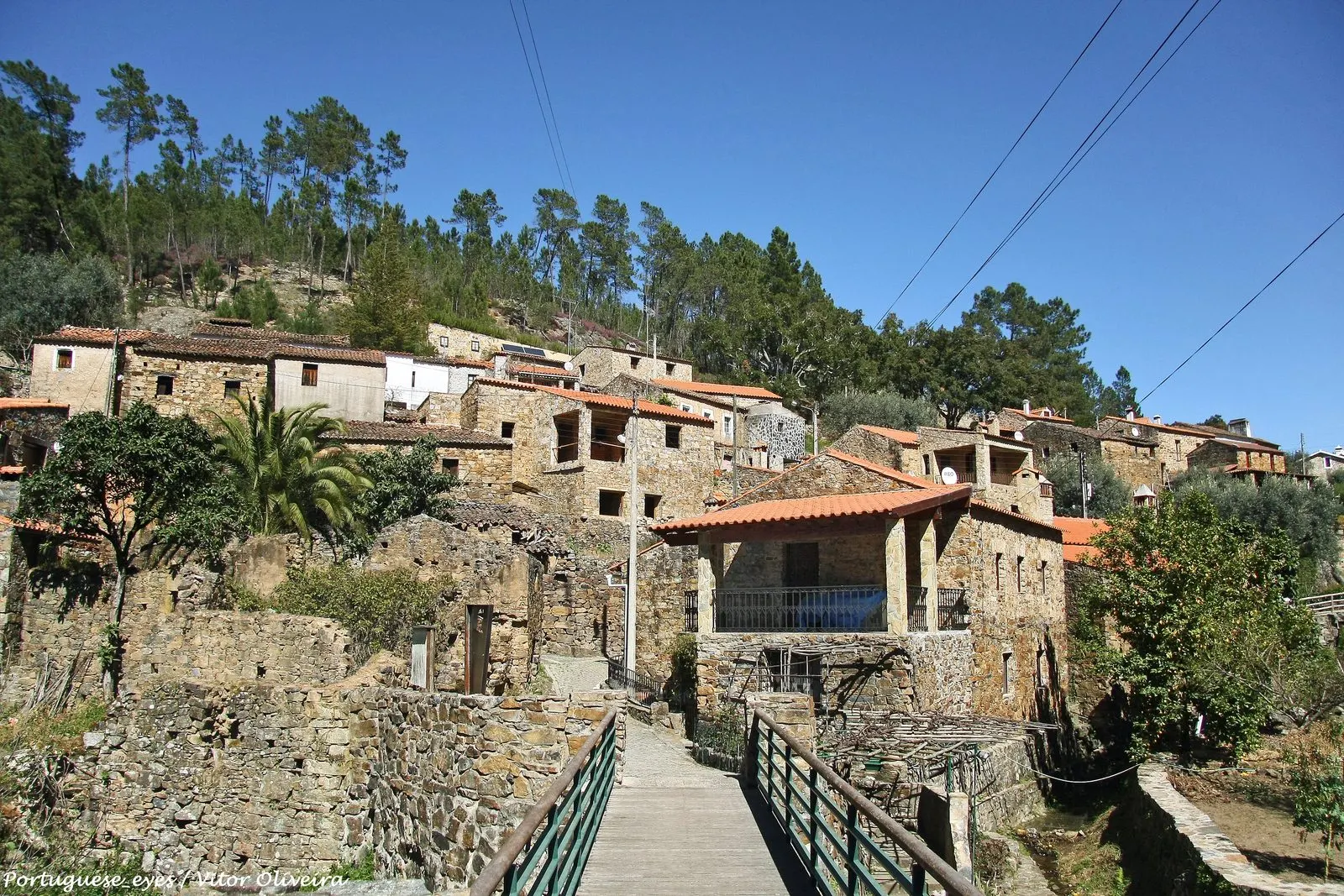
The Tejo-Ocreza territory is the southernmost unit of the Schist Villages network. According to the official portal as consulted on 5 November 2026, it comprised four villages in three municipalities: Água Formosa (Vila de Rei), Figueira (Proença-a-Nova), Martim Branco and Sarzedas (both in Castelo Branco). Here the mountains give way to heathland. The streams that run through the villages flow into the River Ocreza and, through it, into the Tagus.
The four villages are very different from one another. Água Formosa is a valley of mills, Figueira an agricultural village without a church, Martim Branco a small riverside settlement, and Sarzedas a former town with a charter. This guide follows the official records of the network and the national register of listed heritage. Membership of the network is not a heritage designation.
Água Formosa: the village of the spring and the water mills
Água Formosa, in the municipality of Vila de Rei, sits on a south-facing slope between the Corga stream and the Galega stream. The official record places it about 10 km from the Geodesic Centre of Portugal. The houses occupy mainly the left bank of the Galega, the sunnier side, in narrow streets descending towards the water. According to the same record, the name comes from a spring of very pure water. Today it is reached by a paved path with stone steps, and an opening in the rock serves as a reservoir.
The village’s origins are unknown, though it is presumed to be old. The water explains its settlement, and tradition attributes the first mills on the Galega to millers who came from elsewhere. Wells, weirs, irrigation channels, terraces and the memory of the picotas (water-lifting devices) survive. Of some twelve water mills that once lined the stream, three remain. In the consultation of 5 November 2026, the record indicated that only one was working. Residents divide the small village into ten localities with their own names, such as Badalinho, Tulhas, Lajes, Labrusca and Rua da Eira.
Contrary to what the network’s name suggests, the predominant material is quartzite, with a good deal of schist. The lintels are of cork oak and olive wood, and some houses keep the traditional rough render. The ground floor housed animals and farm tools, and the upper floor the living quarters. Worth seeing are the Eira dos Réis, the wood-fired oven still in use, the footbridge over the Galega and the Ferrugenta olive press. According to the record, the permanent population rose from four people in 2002 to nine.
Figueira: doors against wolves and a communal oven
Figueira, in the municipality of Proença-a-Nova, lies where the southern flank of the Alvelos range gives way to heathland. The village is almost flat, and the valley of the Figueira stream marks its northern limit. This stream, torrential and short-lived, flows into the Moitas stream, then the Ocreza and finally the Tagus. The core of the village may date back to the 17th century. Several houses have stones with carved dates, some from the 19th century.
The urban fabric has one longitudinal street and several cross streets. According to the tradition recorded in the official record, at night the streets were closed with doors to protect livestock from wolves; traces of these doors remain. Figueira never had a chapel or a bell, and the community was summoned by the sound of a conch-shell horn (búzio). The communal oven, the village’s emblem, seems to date from 1915. Each family claimed its turn with an identified wooden tablet placed on a numbered board. In the consultation of 5 November 2026, the record indicated that the oven still baked bread several days a week.
The construction is of schist, with details the record considers unique within the network: irregular door jambs, walls with slabs set vertically, and yards bounded by slabs stuck into the ground. The most notable house is that of the Balau family, dating from the 19th century, with a private chapel inside. It is not open to visitors. The fountain from the mid-20th century has one section for people and another for livestock. There are mills along the stream, and the last of several olive presses closed in 2010 (see olive oil and traditional olive growing). The Atelier da Aldeia teaches how to make bread.
Martim Branco: the village of the Almaceda stream
Martim Branco, in the municipality of Castelo Branco and the parish of Almaceda, spreads across a sunny slope on the left bank of the Almaceda stream. The stream bounds the village to the west and flows into the Tripeiro River, a tributary of the Ocreza. The official record places the village 24 km from Castelo Branco and 2 km from the EN112. It also cites Pimentel (1881), for whom almaceda would be a name of Arabic origin meaning «abundant waters». The place name Martim Branco seems to derive from a personal name, and covers two settlements: Martim Branco Fundeiro, the older, and Martim Branco – Eiras, further upstream.
The record links the effective settlement of the parish to the charter of Sarzedas, of 1212. It also states, without qualification, that the village has no built heritage of a religious or cultural type. Its interest lies in the ensemble: Rua da Bica, running parallel to the stream and probably the original street, the Rua Principal, straw barns, communal ovens and weirs. Schist and rammed earth predominate, with light-coloured cobbles on the façades and some houses combining schist and granite. The record also highlights the door hardware, latches and locks, and the wood-fired ovens. By the stream are water mills for rye and maize.
Sarzedas: the former town of the heath
Sarzedas, also in the municipality of Castelo Branco, 18 km from the city, is the most urban of the four. It sits on the heath, on higher ground, beside what was the main road from Castelo Branco to Proença-a-Nova, Sertã, Abrantes and Coimbra, from the 18th century until well into the 20th. A Latin funerary plaque from the 1st century, found at the end of the 19th century and later lost but known from a transcription, attests to a Roman presence (see epigraphy).
The documented history begins in 1210. King D. Sancho I then asked the council of Covilhã for lands for his son D. Gil Sanches and for the archdeacon Paio Pais. The two granted a charter to Sarzedas in 1212, according to the customs of Covilhã. D. Manuel I confirmed it in 1512, which is thought to have led to the construction of the pillory. Between 1630 and 1748, the town gave its name to the Counts of Sarzedas, and the official record presents it as the only Schist Village with a noble title. A violent period followed. In 1762, during the Seven Years’ War, the invading Franco-Spanish army established its headquarters here. Napoleonic troops looted the Mother Church in 1807 and again in 1808. In 1846, a riot burned the municipal archive. According to the official record, the municipality was abolished in 1848.
The Pillory of Sarzedas is a Property of Public Interest under Decree No. 23 122 of 11 October 1933 (see pillories). On the Alto de São Jacinto, the bell tower of the former church stands isolated beside the Mother Church and serves as a viewpoint over the heath. The record also highlights the Chapel of the Misericórdia, the Fonte da Vila, the Chapel of São Pedro (dated 1603) and the Chapel of Santo António. The walls are of schist with light rounded cobbles, granite at the openings and sometimes rammed earth. Most façades are rendered and painted with coloured bands typical of Beira Baixa.
Classification and geopark
In the Cultural Heritage Atlas, the only listed property found in the four villages is the pillory of Sarzedas. No listed property appeared in the parishes of Vila de Rei, Sobreira Formosa and Alvito da Beira (where Figueira lies) or in Almaceda. The consultation does not replace the municipal inventory. According to the managing entity, the territory of the Naturtejo Geopark includes the municipalities of Castelo Branco and Proença-a-Nova, where Figueira, Martim Branco and Sarzedas lie. Vila de Rei is not part of it.
Planning the visit
The four villages are some distance from one another. Água Formosa is reached by the N2, from the A23 (Abrantes Norte exit). Figueira lies near the IC8, close to Moitas. Martim Branco and Sarzedas are north and west of Castelo Branco, a little over ten kilometres apart. In the consultation of 5 November 2026, the official records listed these Schist Trails: the PR4 VLR in Água Formosa, the PR8 PNV («Por Muros de Xisto») in Figueira, the PR2 CTB and PR7 CTB («Rota dos Lagares») in Martim Branco, and the PR3 CTB («Nos poços mineiros») in Sarzedas. They also indicated cycling routes from the Cyclin’Portugal centres of Sarzedas and the Fróia river beach. Figueira’s agenda announced the Proença Cross Trail on 4 December 2026.
Confirm dates, trail conditions and services on the official village records or with the municipalities. Many of the houses mentioned are privately owned. The other villages in the network are in Schist Villages of the Lousã Range, Schist Villages of the Açor Range and Schist Villages of the Zêzere. For building techniques, see schist houses and vernacular architecture; for the region, see Centro.
Photograph by Vitor Oliveira, 4 April 2015. Original on Wikimedia Commons, under CC BY-SA 2.0; resized and compressed for the web, without altering the composition.

Frequently asked questions
- What are the Schist Villages of Tejo-Ocreza?
- According to the official portal as consulted on 5 November 2026, there are four: Água Formosa (Vila de Rei), Figueira (Proença-a-Nova), Martim Branco and Sarzedas (both in Castelo Branco).
- What listed heritage exists in these villages?
- In the Cultural Heritage Atlas, the only listed property found in these villages is the Pelourinho (pillory) of Sarzedas, a Property of Public Interest under Decree No. 23 122 of 11 October 1933. The record for Martim Branco states that the village has no built heritage of a religious or cultural type.
- Do the villages belong to the Naturtejo Geopark?
- Figueira, Martim Branco and Sarzedas lie in the municipalities of Proença-a-Nova and Castelo Branco, which, according to the managing entity, form part of the geopark's territory. Vila de Rei, where Água Formosa is located, does not appear on that list.
- Why are not all of them pure schist villages?
- In Água Formosa, the official record gives quartzite as the predominant material, with a lot of schist. Martim Branco combines schist, rammed earth and some granite, and in Sarzedas most façades are rendered and painted.
Sources
- Aldeias do Xisto — Território e unidades territoriais
- Aldeias do Xisto — Água Formosa
- Aldeias do Xisto — Figueira
- Aldeias do Xisto — Martim Branco
- Aldeias do Xisto — Sarzedas
- Património Cultural, I.P. — Atlas do Património Classificado (consulta por freguesia)
- Diário do Governo — Decreto n.º 23 122, de 11 de outubro de 1933
- Naturtejo — Quem Somos
- Wikidata — povoações de Água Formosa, Figueira, Martim Branco e Sarzedas